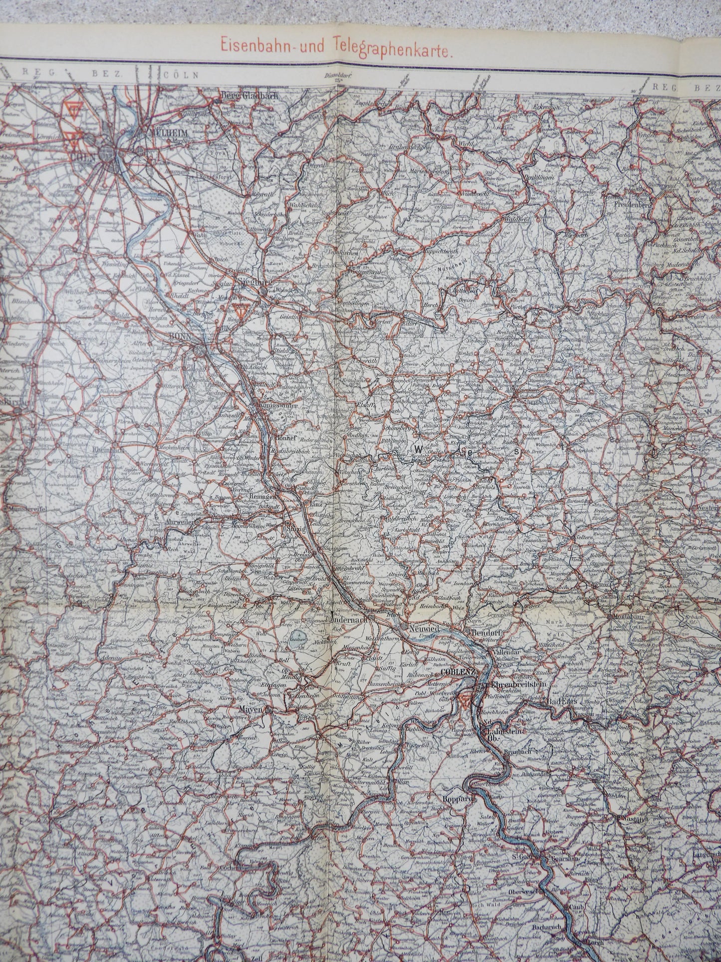
Orginal 1915 German map showing the Railroads and Telegraph connections in Koblenz, Cöln and Cologne 1909.
Debated area during the First World War, this map is a military Staff Map showing heights, connections and roads. Showing cities: Koblenz, Boppard, Cochem, Mainz, Wiesbaden, Keulen/Cöln. Strategy important areas since the Napoleonic war.
This kind of map would have found use for logistic, planning, railroad and resupply routes.
It's in remarkable good state showing a handfull of tiny holes but no sever damage for a 100+ year old German map.